


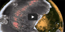
Sun's Position Over Earth
(to update, reload page)
Courtesy:
Fourmilab Switzerland
View Earth's Night Half
Day, Night & the Analemma
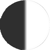
Earth Tilt, Sunrise & Sunset
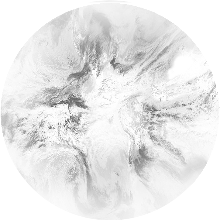
No Sunlight on Entire Earth
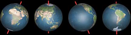
Six Current Views of Earth
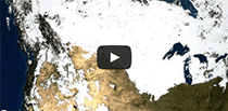
Current Earth Weather

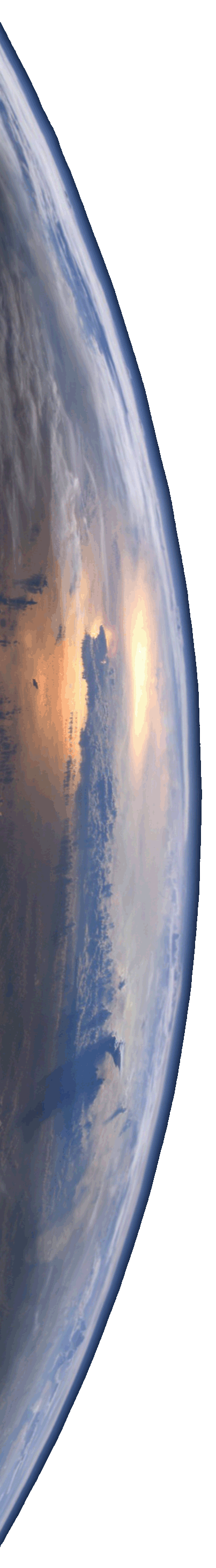
"PLANET OF LIFE!"
Earth, the cradle of humankind, is a watery world and the only planet on which life is known
to exist! (1.6.x)
(1.4.1)
Earth is the third planet from the Sun, and the one against which all other planets are measured! (1.6.x) (1.4.1)
Not familiar with Celestia's 1.6.x and 1.4.1 links? For an explanation click here.
When you run Celestia's links above that display planetary orbits, Right Drag to reveal them in 3-D: shapes, sizes and inclinations.
EARTH'S SEASONS
Why Earth Has Seasons:
NASA graphic
The Reasons for Seasons is a terrific interactive showing how Earth's tilt and motions create our seasons.
Why Do We Have Seasons? is another great interactive.
And here's another!
How Earth's Snow & Ice Cover Vary with the Seasons
ASTRONOMICAL VS METEOROLOGICAL SEASONS
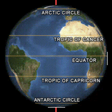
Most school children know the "meteorological" seasons of the Northern and Southern Hemispheres are the reverse of each other's. For example, meteorologically-speaking, it is Summer in the Northern Hemisphere when it is Winter in the Southern Hemisphere.
Nonetheless, the equinoxes and solstices of the "astro- nomical" seasons have tra- ditionally been named for the "meteorological" seasons of the Northern Hemisphere. (This is probably because 87% of Earth's population lives there!) So, what is commonly called the "Sum- mer Solstice", is actually the solstice in June that marks the start of the "Northern" Hemisphere's summer.
Unfortunately this traditional naming convention creates an ambiguity. It means that the "Southern" Hemisphere experiences the traditional Summer Solstice at the be- ginning of its "meteorologi- cal" Winter!
This is why we increasingly see the less recognizable (yet actually more appropriate) terms: March Equinox, June Solstice, September Equinox and December Solstice. Be- cause these terms eliminate the traditional ambiguity, it has become preferable in astronomical circles to use them when referring to the equinoxes and solstices.


WHY THE LENGTHS
OF THE SEASONS
ARE NOT EQUAL
Since their beginnings and ends are strictly defined by the arrival of the Sun at the equinoxes and the solstices in our sky, our astronomical seasons have durations of specific lengths. Although many people believe that the lengths of the astronomical seasons are the same, this proves not to be the case. This is because, while the equinoxes and solstices are spaced at equal intervals of 90° around the Celestial Sphere, Earth's changing velocity in its elliptical orbit causes the Sun to appear to arrive a little early at parts of the sky, and a little late at others. For the Northern Hemisphere, Summer thus becomes the longest of the "astronomical" seasons and Winter the shortest.
Lengths of the
Northern Hemisphere's "Astronomical" Seasons
Spring: 92 3/4 days
Summer: 93 2/3 days
Autumn: 89 5/6 days
Winter: 89 days.
Of course, in the Southern Hemisphere, "Astronomical" Seasons are the reverse of those above. Therefore . . .
Lengths of the
Southern Hemisphere's "Astronomical" Seasons
Autumn: 92 3/4 days
Winter: 93 2/3 days
Spring: 89 5/6 days
Summer: 89 days.
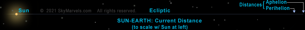
PERIHELION
& APHELION
When is Earth at perihelion and aphelion, respectively the points in its orbit closest to and furthest from the Sun?
Contrary to popular belief, Earth is closest to the Sun during the Northern Hemi- sphere's winter, NOT sum- mer! Conversely, Earth is farthest from the Sun during the Northern Hemisphere's summer, NOT winter! This indicates that our seasons are not caused primarily by Earth's varying distance from the Sun. No, our seasons are actually caused primarily by Earth's changing tilt in its or- bit relative to the Sun!
In contemporary times Earth is generally closest to the Sun between January 2 and January 6, and farthest from the Sun between July 3 and July 7. NASA Graphic
The excellent AstroPixels site provides a very good chart of Earth at Perihelion and Aphelion: 2001 to 2100.
EARTH ACTIVITIES
MAKE COOL PAPER MODELS OF EARTH
CANON has a cool website that offers free downloads, including one that lets you make a cool 3-D paper model of Earth For an even greater challenge, make a 3-D paper puzzle of Earth!
MAKE PAPER MODELS OF SPACE SHUTTLE
CANON's same cool website offers these free models of the Space Shuttle:
Orbiter (realistic)
Orbiter (simplified)
Orbiter on 747
Fuel Tank-Boosters (real.)
Fuel Tank-Boosters (simp.)
Make them all!
MAKE PAPER MODEL OF ORION SPACECRAFT
NASA's new spacecraft will take us back to the Moon and beyond: 3-D paper model of Orion.
MAKE PAPER MODEL
OF HUBBLE
SPACE TELESCOPE
NASA's space observatory Hubble opened our eyes to the vastness of the universe!
3-D paper model of Hubble Space Telescope ![]()
MAKE PAPER MODEL
OF JAMES WEBB
SPACE TELESCOPE
NASA's space observatory at Earth-Sun L2 point will look deeper into space and further back in time than Hubble!
3-D paper model of JWST. Blueprint (high res) ![]()
MAKE YOUR OWN COMPASS
From the National Oceanic & Atmospheric Admin. (NOAA), here's an activity that's fun! And potentially useful too! Make Your own Compass. Moreover, when you use the compass you make, you'll be confirming that Earth has a magnetic field!
VERIFY HOW
GRAVITY WORKS
For thousands of years even the smartest people in the world accepted that heavier objects always fell to Earth faster than lighter objects. After you do the following simple little experiment, you will surely wonder why they never did something similar themselves! And you'll be smarter than they were (well —about gravity anyway.)
Drop a quarter and a dime at the same time. (Note: the former is over twice as heavy as the latter!) Does one fall faster than the other? Does it make any difference if you drop them at the same time from a different height? To be sure of your answer, go ahead and repeat this quick experiment several times. It won't take you long to know more about gravity than the ancient "experts" did!
CELES-TIPS
The following will help you enjoy this page's 1.6.x and 1.4.1 links that run events directly in CELESTIA. If you're new to the program, these tips will also help you learn to use it.
You'll find more information about many of CELESTIA's controls on our Learning Center page.
![]() EARTH
EARTH
(to update, reload page) Courtesy: Fourmilab Switzerland

View Earth in 3-D 3-D in Orbit
WorldWind Explorer
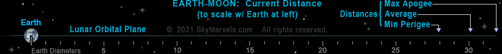
Current Distances and Views from the Sun and Moon
Current View of Earth & Moon from Sun Interactive
Current Location in Orbit
Physical Properties:
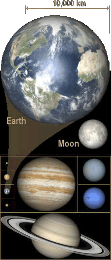
Diameter: Compare Compare in 3-D
Equatorial: 12,756.274 km Polar: 12,713.504 km
Rotational Flattening: 0.003353
Mass: 5.9724 trillion trillion tons
Volume: 1.08321 trillion cubic kilometers
Mean Density (Water = 1): 5.52
Surface Gravity (standard): 9.81 m/s
2
Surface Temperatures: average 14°C (57°F) ![]()
Axial Tilt: 23.44° ![]() (1.6.x)
(1.6.x)
 Variation: 22.1° - 24.5°; 41,000-yr cycle
Where Poles Point ![]()
Rotation:
Period:

Synodic ("Day" in Earth hrs): 24.00
Sidereal (in Earth hrs): 23.9345
Surface Speed vs Latitude
Albedo (geometric): 0.37
Magnetic Field
![]()
![]()
Previously Unknown Radiation Belt
Van Allen Belts
![]()
 Magnetopause
![]()
Solar Interaction
Comparison
More Earths in 3-D:
NASA's Overview of Earth Globe Viewer
WebGL Earth ![]() Point & Opposite Point (zoom in)
Point & Opposite Point (zoom in)
Web GL Hello World Globe zoom way in!
SketchFab Alt+Drag moves shadows #2 #3
Location & Antipode Lots of Globes

Earth Surface:
Land Area: 29.2%
Area Covered by Water: 70.8%
The World's Water ![]()
NASA / JPL's Photojournal pages for Earth
Maps and Globes:
USGS: The National Map (great mapping tool)
NatGeo MapMaker (Layer 41 adds Time Zones)
Interactive Album of Map Projections 2.0
MetaBunk Earth Route Simulator
Standard Time Zones of the World Another
Population Density 3-D Another 2-D
DSN Current Day & Night Map
Biome Viewer
Earth's Dynamic Surface:
USGS "This Dynamic Earth" online edition
USGS "This Dynamic Planet" Front Back Site
U.S. Volcanoes Hazards Program and Map
Plate Tectonics: Plate Borders & Motions
NASA GSFC Plate Boundaries: Oceans Drained
USGS How Plate Tectonics Works ![]()
NOAA's Natural Hazards Viewer
Tectonic Explorer
Earth's Paleo-History: Maps, Apps & Vids
Earth Viewer (3-D ) Awesome interactive!
What Did Earth Look Like "___" Years Ago?
From USGS, the Breakup of Pangaea ![]()
Pangaea Fossil Distribution ![]()
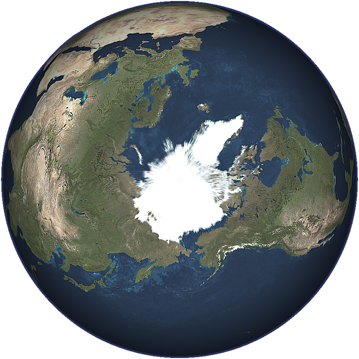
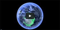
EARTH FROM ABOVE ITS NORTH POLE
(at its Equinoxes)
Earth Atmosphere:
Structure:
NASA Graphic 1 NASA Graphic 2
NASA Video ascending through Atmosphere
Composition
![]()
Earth Structure:

3D Earth Exploded View
Compared to Other Inner Planets
Earth Structure Video
Spacecraft in 3-D:
 Boeing CST-100 Starliner
![]()
Explorer 1: #1 #2
![]()
Hubble: #1 #2
![]() #3 #4
#3 #4
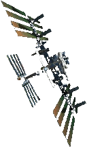
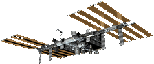
ISS: #1 #2 #3 #4
![]() Tour
Tour
JWST: #1 #2 #3 Bluepr ![]()
Mir Space Station
SpaceX Crew Dragon
![]() Sim
Sim
Comparison of Earth-Satellite Orbital Geometries
Ring System: No
Planet Classifications:
Inner Planet (along with Mercury, Venus & Mars)
Terrestrial Planet (defines term)
Reference Planet:
Planets with smaller orbits are Inferior Planets
Planets with larger orbits are Superior Planets
Earth Orbit:
(1.6.x)
(1.4.1)
Name of its Plane: "The Ecliptic"
Period (sidereal) : 365.2564 solar days
Period (tropical) : 365.2422 solar days
Distance from Sun:
Mean: 1 AU (essentially defines measurement),
149,597,870.7 km (defined in 2012)
Dates of: early Apr, early Oct (current era)
Perihelion: 147,098,300 km (0.9833 AU)
Date of: betw. Jan 2 and Jan 6 (current era)
Aphelion: 152,097,400 km (1.0167 AU)
Date of: betw. Jul 3 and Jul 7 (current era)
From perihelion to aphelion, Earth's orbital velocity is continually decreasing! From aphelion to perihelion, it is continually increasing!
Velocity:
Mean: 107,240 km/hr
Dates of: early Apr, early Oct (current era)
Min: 105,440 km/hr
Date of: betw. Jul 3 and Jul 7 (current era)
Max: 109,040 km/hr
Date of: betw. Jan 2 and Jan 6 (current era)
Eccentricity: 0.0167
Compared to Perfect Circle ![]()
Orbit's Inclination to Ecliptic: 0° (it IS Ecliptic)
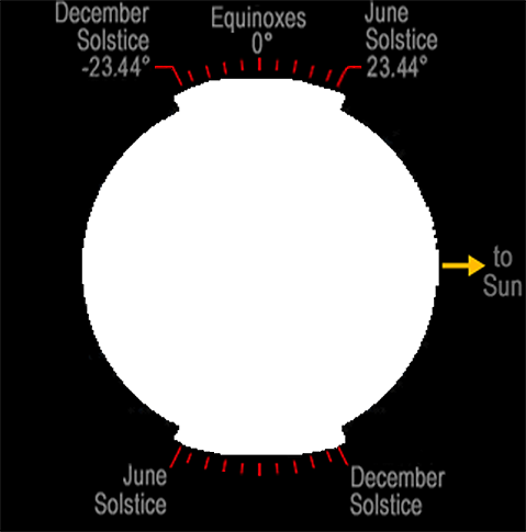
Equinoxes & Solstices ![]()
Perihelia & Aphelia ![]()
VIEW EARTH'S VARYING TILT RELATIVE TO THE SUN
Tilt our planet with the slider control. Its animation, and the one just above it, show how Earth's orbital position and tilt (relative to the Sun) are directly related.
Milankovitch Cycles ![]()
![]()
Orbital Cycles:
Orbital Eccentricity:
Period: approx. 100,000 yr
Min. Eccentricity: 0.000055 (NASA: 0.0034)
Max. Eccentricity: 0.0679 (NASA: 0.058)
Apsidal (Perihelion) Precession:
Period: approx. 112,000 yr
Axial Cycles:
Obliquity (Axial Tilt):
Period: approx. 41,000 yr
Min. Tilt: 22.1°
Max. Tilt: 24.5°
Axial Precession: (Precession of Equinoxes) ![]()
Period: 25,800 years
North Axis Direction: (J2000)
Right Ascension: 18h 0m 0s (270.00°)
Declination: 66° 33' 38.55" (66.56°)
In Constellation Draco
North Axis Map South Axis Map
Global Warming
View of Earth in CELESTIA:
With Location Labels ON: (1.6.x)
(1.4.1)
With Location Labels OFF: (1.6.x)
(1.4.1)
Number of Moons: 1 (Luna, aka "The" Moon)
NASA's Overview of the Moon
Compare to Other Moons
Spin-Orbit Resonance with Earth: Yes, 1 to 1
(so the same side of Moon always faces Earth)
View Earth-Moon Barycenter video
Partial Information Source: NASA Fact Sheets
ADJECTIVES MEANING
"pertaining to Earth"
earthen, earthly, earthy
geo-, geological, geotic
terran (often capitalized), terrestrial, terrene (all from Latin: Terra)
telluric, tellurian
EARTH'S TILT (current)
Equinoxes, Solstices & the
Sun's Apparent Motion
THE SUN'S LOCATION IN EARTH'S SKY

The Sun's Skypath Poster
Motion of the Sun Simulator
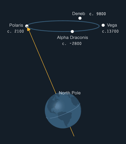
EARTH'S PRECESSION
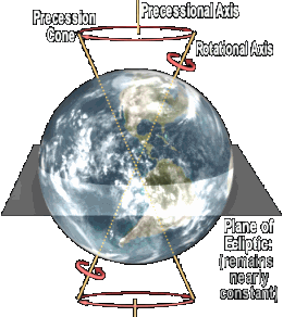
Earth's precession is its gradual "wobble" that causes each of our home planet's poles to trace a circle against the background stars every 25,800 years. The result of gravitational forces primarily of the Sun, the Moon and Jupiter on our planet's equatorial bulge, this fundamen- tal motion of Earth is not unlike that of the precession
of a gyroscope. The effect causes our planet to have different North Stars during its 25,800-year cycle!
North Axis Map South Axis Map
Our current North Star is Polaris (alpha Ursae Minoris), though Thuban (alpha Draconis) was our North Star in the era when the pyramids were being built! Above you can see when Deneb and Vega will be our North Stars.
Unlike Earth's rotational axis, its "precessional axis" is essentially fixed. While its north end points toward the constellation Draco, its other end points toward the southern constellations of Dorado and Pictor. Around this axis, the direction of Earth's wobble is clockwise when we look down on Earth's Northern Hemisphere.
You can find an explanation of how you may view Earth's precession in CELESTIA 1.6.x on our Tips page.
TOURING THE OCEAN BOTTOM
video credit: NOAA, US Dept of Commerce
EARTH'S WATER CYCLE
video credit: NASA
WATCHING EARTH BREATHE
video credit: NASA/JPL Caltech
NASA: Aquarius Ocean Circulation
video credit: NASA/Goddard Space Flight Center
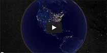
EARTH AT NIGHT
video credit: NASA Earth Observatory
EARTH FROM ORBIT 2012
video credit: NASA
IMAGE Spacecraft Picks up Earthly Aurora
video credit: NASA/IMAGE Mission
NASA: A Landsat Flyby
video credit: NASA Goddard Space Flight Center
Also check out the videos on our Earth Weather page.
LINKS TO MORE NASA VIDEOS & INFO
You must have the noted player installed to view these. Note: you might have to click on these more than once, as some NASA servers (like https://svs.gsfc.nasa.gov in particular) can be temperamental and slow to connect. If a video does not load, try again at another time.
Draining the Oceans. Intriguing View of Earth without its Oceans! (QuickTime) Video Credit: NASA/Goddard Space Flight Center Scientific Visualization Studio. U.S. Department of Commerce, National Oceanic and Atmospheric Administration, National Geophysical Data Center, 2006, 2-minute Gridded Global Relief Data (ETOPO2v2). The Blue Marble Next Generation data is courtesy of Reto Stockli (NASA/GSFC) and NASA's Earth Observatory.
Ocean Current Flows Around the Mediterranean Sea. (Windows Media Player or QuickTime) Video Credit: NASA/Goddard Space Flight Center Scientific Visualization Studio.
Earth's Water Cycle: Video Tour from NASA/Goddard Space Flight Center.
Hourly Evaporation from the GEOS-5 Model. Note how evaporation, fueled mainly by the Sun, varies with day and night much more greatly over land than over the oceans. (QuickTime) Video Credit: NASA/Goddard Space Flight Center Scientific Visualization Studio
The Blue Marble data is courtesy of Reto Stockli (NASA/GSFC).
Home Intro News Gallery Sky-Gifts Bonuses Tips
Learning Ctr Help Links Credits Legal Contact Us
© 2007-
by Gary M. Winter. All rights reserved.
Interested in political cartoons and humor?
Check out The HIPPLOMATS™.
SkyMarvels, Sky Marvels, SkyMarvels.com, All about Earth! Earth's 12-Month Heartbeat! Earth Day-Night Map, Daylight Map, Daylight World Map, sunlight world map. Earth's Position in its orbit! Earth Interactives. Earth Animations. Earth Maps! Earth Activities! Earth Seasons! Earth Satellite Info! celestia4all, celestiaforall, CELESTIA, astronomy, space, simulations, animations, downloadable astronomy posters, stars, planets, Inner Planets, Outer Planets, Inferior Planets, Superior Planets, moons, asteroids, comets, Oort Cloud, galaxy, galaxies, Milky Way, Andromeda, globular clusters, binaries, quasars, black holes, supermassive black holes, telescope, telescopes, planetarium, software, freestuff, satellites, add-ons, addons, scripts, eclipses, Solar Eclipses, Lunar Eclipses, Solar Eclipse Finder, Lunar Eclipse Finder, mutual eclipses, transits, occultations, Solar System, CELES-TOOLS, celeSTARrium, CELX, CELX programming, Freebies, Bonuses, multiple views, atronomical unit, light year, parsec, meteors, meteor showers, Perseids, Geminids, Leonids, barycenter, time, Time Zones, tides, alignments, conjunctions, oppositions, seasons, apogees, perigees, aphelion, perihelion, Earth, Luna, Mercury, Venus, Mars, Jupiter, Galilean Moons, Io, Europa, Ganymede, Callisto, Saturn, Titan, rings, Uranus, Neptune, Triton, E-MSpectrum, electromagnetic spectrum, astronaut, equinoxes, solstices, precession, rotation, spin, inclination, tilt, Ecliptic, orbits, ellipse, parabola, hyperbola, USGS Daily Earthquake Map

Donate safely with: PayPal
and receive one or more
Sky-Gifts. Your support is greatly appreciated!
NOTE: you do not need a PayPal account to donate.
SKY VIEWING
SOLAR SYSTEM
THE SUN
MERCURY
VENUS
EARTH
THE MOON
MARS
JUPITER
SATURN
URANUS
NEPTUNE
SMALLER WORLDS
STELLAR OBJECTS
EXOPLANETS
DEEP-SKY OBJECTS
SCALE OF THE COSMOS
———————
SKY-FUN / SKY-GAMES
Earth's Mean Tilt Today
relative to the Sun
USGS's LATEST

Daily Earthquake Map
The National Map
EarthExplorer
Waters GeoViewer
CO2 Viewer
NOAA's LATEST
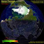
Aurora Forecast: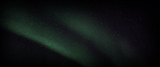
N Lights: (Aurora Borealis)
S Lights: (Aurora Australis)
NASA's LATEST
ISS (Int'l Space Station) Info:
Live ISS Stream Spot the Station
ESA's LATEST
EARTH FUN FACTS
About 87% of our planet's human population resides in the Northern Hemisphere! Here is a site that represents this in a very cool 3-D map- graph: World Population
All of Earth's water would fit into a sphere about 1,380 km (860 miles) in diameter! ![]()
3% of Earth's water is fresh water; 97% is salt water!
Glaciers contain roughly 2/3 of Earth's fresh water!
At present, glaciers blanket roughly 1/10 of Earth's land area. During the last major Ice Age about 10,000 years ago, they blanketed almost 1/3 of Earth's land area!
The area of the Pacific Ocean is greater than the area of all the land on Earth combined!
In its orbit around the Sun, Earth's speed (on average) increases by roughly 1 km/h every hour between aphelion and perihelion! On average
it decreases by that same amount every hour between perihelion and aphelion!
You weigh more at the poles than at the Equator! About
a half of one percent more! This is because Earth rotates on its axis, creating centrif- ugal effect, which decreases your weight most greatly at the Equator!
For the same reason, Earth bulges at the equator. The result is that sea level at the equator is about about 21 kilometers (about 13 miles) further from Earth's center than sea level at the poles!
In the Northern Hemisphere spring is about three days longer and summer is close to five days longer than in the Southern Hemisphere!
. . . likewise . . .
In the Northern Hemisphere autumn is about three days shorter and winter is close to five days shorter than in the Southern Hemisphere!
The umbra, the dark portion of Earth's shadow, has an average length nearly equal to the diameter of the Sun!
Astronauts on board the International Space Station witness 16 sunrises and 16 sunsets every 24 hours!
EARTH INTERACTIVES
QUICK ACCESS LIST
Note: some links are echoed elsewhere on this page and may include descriptive text.
NASA's Overview of Earth lots of tings to do here.
NASA's WorldWind Explorer Earth (in 3-D!) Takes you to destinations, lets you show day and night, time zones and more!
Comparison of Earth Satellite Orbital Geometries
Rendezvous! is a cool satel- lite orbit simulation! Can you rendezvous with the "target vehicle"?
ESA's fantastic ISS Virtual Tour takes you all over the International Space Station! Map at upper right tells you where you are and lets you "jump" to different modules.
ISS Docking Simulator from SpaceX
Newton's Cannon! helps you understand the velocity re- quired to orbit Earth.
Newton's Cannon! another version, this from KCVS/ca
These two sites #1 & #2 provide startling 3D views of satellites currently orbiting Earth! Kessler Syndrome
Links to interactive features that show Earth's orbit in 3-D can be found on our Solar System page
Here's a NASA "Special": Ocean Worlds ![]()
![]()
Is our climate changing? Find out here with NASA's Climate Time-Machine
Discover the application of space-related discoveries and improvements in everyday things all around you in this very cool 3-D feature: NASA Home and City. Takes a moment to load. Home City
From the ESO, here's a very nice 3-D interactive of the Hubble Space Telescope
From NASA: 3D Resources
Roughly 90% of our planet's human population resides in the Northern Hemisphere! World Population shows Earth as a cool 3-D graph to give you a feel for this.
SKYMARVELS™
CELESTIA ADD-ONS FEATURING EARTH
SKYMARVELS™
POSTERS FEATURING EARTH
SKYMARVELS™
VIDEOS FEATURING EARTH
Solar Eclipses:
Lunar Eclipses:
Moon's Occultation of Venus 2010 May 16
Moon's Occultation of Venus 2010 Sep 11
The Same Side of the Moon Always Faces Earth